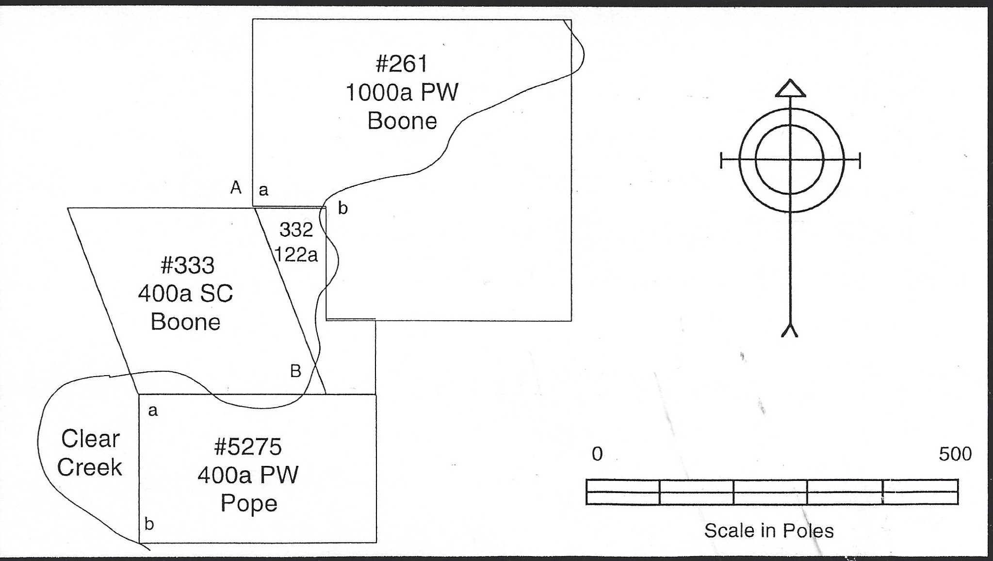
Original Land Surveys
Due to his extensive research, author and historian Neal O. Hammon is considered the expert in information on Kentucky land claims. He spent countless hours poring over records and producing maps of the area covered by the land claims, such as these in our collections.
Such original records were created by surveyors who flooded into Kentucky shortly after Daniel Boone opened up the trail through the Cumberland Gap. Their intent was to claim and sell land. Surveys were handwritten and usually contained a diagram of the property with a rough drawing of the topography and streams or landmarks. Amazingly, many originals still survive today.
To research such a project, Hammon would often visit county courthouses and make copies of early land surveys. He would also painstakingly transcribe the hand-written portion to make them more readable. For this collection, he created a map for each entry, added a brief description, and relevant information. Hammon was a sixth-generation Kentuckian and long-time member of the Shelby County Historical Society.
According to the United States Census Bureau, Shelby County has a total area of 386 square miles (1,000 km2), of which 380 square miles (980 km2) is land and 6.0 square miles (16 km2) is water. We have Neal O. Hammon to thank for mapping out each original land survey for what became Shelby County, KY.
This document's content is restricted to members only
To access this information, you must be a member of the Shelby County Historical Society, as this is one of our many Member Perks. To do so, please click the Join Us link below where for as little as $25 annually, you can become a member today and enjoy this great benefit, along with many more benefits.